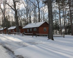
Harbor Springs Trail Report – 01/30
HARBOR SPRINGS AREA UPDATE via Harbor Springs Snowmobile Club – 01/30
We had a great turnout Saturday for the 6th Annual Vintage ride hosted by Beach’s Up North Tavern & Warren Fosmore! A huge thank you to both of them for putting this on every year and especially to Warren for collecting all of the donation items for the auction. I think he tries to one up himself every year! Another huge thank you to everyone that donated an item or gift card to the auction, we ended up raising a little over $6,200 for the club. As always this event is a blast & we can’t wait until next year. Thank you everyone for coming out!
The railroad grade was groomed last night & we received about 4” of fresh snow over night as well.
Looks like Mother Nature is finally giving us a winter! Ride right & ride safe!
<>
<>
Postings From Regional Pages On Facebook

WEATHER UPDATE via Michigan Storm Chasers >> This is our last call snowfall outlook for FRIDAY ONLY, January 16th, 2026. Snow has begun across parts of the UP, and will begin for the rest of the state over the course of the next 12 hours.... #miweather #keweenaw #westernup #marquette #munising #seney #newberry #soo #straitsarea #gaylord #cadillac #benzie #traversecity #petoskeyThis is our last call snowfall outlook for FRIDAY ONLY, January 16th, 2026. Snow has begun across parts of the UP, and will begin for the rest of the state over the course of the next 12 hours.
A clipper will bring a mixture of synoptic snow and lake effect snow for the entirety of Michigan. This is the first of multiple clippers between now and Monday. Lake effect areas may see totals into the 4-8" zone, with localized heavier totals possible along the Porcupine Mountains in the western UP. We DO have ample moisture on our atmospheric profiles for tomorrow, but the forcing is still suspect, so a solid blanket of 1-4" of snow, with isolated higher totals close to half a foot should occur by the end of our day Friday. The greatest chance at an area underachieving is in... guess what... southeast Michigan. Monroe and Lenawee counties specifically were in the T-1" zone at first call, but with a more-moist profile expected tomorrow, all locations (in an ideal world) should at least hit 1". We are also watching for the development of freezing drizzle mixing in, primarily in the Lower Peninsula as low-level temperatures favor this phenomena. Now, drizzle would hinder totals, but significantly increase travel issues as roads get coated with both the drizzle and the wet snow. We will have a freezing drizzle accumulation map out tomorrow morning.
Winds gusting 25-35 mph at times, primarily out of the west. Some snow squalls will mix in, which for those who don't remember, snow squalls exist to only cause headaches. These narrow bands of snow drop visibility from open skies to mere feet in the matter of seconds, which is never good, especially on fast-moving roadways. A snow squall can put down as much as a quick inch in 15-30 minutes at their peak intensity. Both morning and evening commutes will be impacted by snow or drizzle. Let's hope we don't light up the MDOT drive map with 25 accidents this time around, so please take your time. Give yourself that extra hour to travel, especially in instances of forced slow downs.
-- Trusted Partner of the Day --
Rainbow Restoration | 616-583-1234, call today for all your restoration needs in the Grand Rapids regional area!

PETOSKEY AREA UPDATE via Petoskey Snowmobile and ORV Club >> Trails groomed tonight 1-15-2026... #petoskeyTrails groomed tonight 1-15-2026
PETOSKEY AREA UPDATE via Petoskey Snowmobile and ORV Club >> Groomer Report January 15 2026... #petoskey #snowphotos
WEATHER UPDATE via US National Weather Service Gaylord Michigan >> Snow returns tonight west of I-75 before overspreading the rest of the area into Friday. Light accumulations expected for most, but areas near the Lake Michigan shore will see more snowfall… with some spots potentially seeing upwards of 8”+ by Friday evening. Following the system, rounds of lake effect snow are anticipated into next week with colder weather. Be sure to monitor the forecast for the latest updates! #miweather #gaylord #cadillac #benzie #traversecity #petoskey
WEATHER UPDATE via US National Weather Service Gaylord Michigan >> Below zero wind chills continue this morning across most of Northern Michigan. Winds chills will be in the teens below zero or colder in parts of eastern upper and north central Lower Michigan. Be sure to bundle up!
A cold Thursday is ahead, though our weather will otherwise be relatively quiet with decreasing lake effect snow and decreasing winds. Another system will spread snow back into the area late tonight into Friday. Several inches of accumulation are possible near Lake Michigan in both peninsulas. This system will allow temperatures to briefly rebound early this weekend. However, Arctic air settles back in by Monday, with continued lake effect snow showers in the snowbelts. #miweather #gaylord #cadillac #benzie #traversecity #petoskey
WEATHER UPDATE via US National Weather Service Gaylord Michigan >> Lake effect snow showers will continue into tonight across parts of northern Michigan. The highest amounts of additional snow are expected in areas near and southwest of Grand Traverse Bay, with 2-6” this afternoon through tonight.
Cold temperatures will impact the entire region with wind chills below zero this afternoon into Thursday morning. #miweather #gaylord #cadillac #benzie #traversecity #petoskey
HARBOR SPRINGS AREA UPDATE via Harbor Springs Snowmobile Club >> We are only three days away from the 61st Annual Moose Jaw Safari!! The forecast for Saturday is looking to be in the high 20’s with a chance of snow.
We haven’t had groomers out this week yet as temperatures were too warm Monday night & last night. We have some snow on the way today and will have groomers heading out on Thursday and Friday to get the trails ready.
You can still buy your raffle tickets before the event at Beach's Up North Tavern & at Clyde's Place! We will also have them for sale the day of the event.
If you’re bringing your vintage sled, drop a picture in the comments & show it off. #harborsprings #petoskeyWe are only three days away from the 61st Annual Moose Jaw Safari!! The forecast for Saturday is looking to be in the high 20’s with a chance of snow.
We haven’t had groomers out this week yet as temperatures were too warm Monday night & last night. We have some snow on the way today and will have groomers heading out on Thursday and Friday to get the trails ready.
You can still buy your raffle tickets before the event at Beach's Up North Tavern & at Clyde's Place! We will also have them for sale the day of the event.
If you’re bringing your vintage sled, drop a picture in the comments & show it off.
WEATHER UPDATE via Michigan Storm Chasers >> Here is your final look at snowfall totals over a 36-hour period from tonight, through midday Thursday, January 14th through 15th, 2026. NOTE, snow will start overnight for the UP, but later tomorrow morning into the afternoon for the LP.
Discussion
Lake effect snow is the rave with this one. Winds almost directly out of the north coupled with low-level DGZ and strong forcing will allow for many of the areas in dark blue, and especially pink pick up well over half a foot of fresh snow with this event. Hyper-localized banding is expected, which is when the span of 20 miles sees a difference in snow accumulation of 1", to perhaps 12-18". A 1° change in wind direction will help, or hurt your chances at significant snowfall if you're right along the lakeshore areas, especially SW Michigan.
Inland areas will only see under an inch within an initial snow squall and light lake effect afterward. We are not confident that the stretch from Lansing to Port Huron will get more than 1.5", but we put 1-3" just in case. Lake Huron will also show off lake effect snow, with parts of Huron county seeing 4-8". To the north, northwest lower Michigan will see 2-5" and 4-8", with a localized swath of 6"+ near Manistee and points surrounding. Lastly, the UP will see its highest totals along the higher elevation areas of the central portion of the peninsula.
Wind gusts up to 30 mph, even 40-45 mph are likely with this snow, and as a result, near-zero visibilities and drifted roads may occur near each lakeshore. Allow extra travel time when driving on Wednesday in the 4-8", or 6-12"/6-18" zones. We will have radar, weather camera, and traffic updates coming tomorrow as the snow comes down, so drop a follow here at Michigan Storm Chasers for coverage. #miweather #keweenaw #westernup #marquette #munising #seney #newberry #soo #straitsarea #gaylord #cadillac #benzie #traversecity #petoskeyHere is your final look at snowfall totals over a 36-hour period from tonight, through midday Thursday, January 14th through 15th, 2026. NOTE, snow will start overnight for the UP, but later tomorrow morning into the afternoon for the LP.
Discussion
Lake effect snow is the rave with this one. Winds almost directly out of the north coupled with low-level DGZ and strong forcing will allow for many of the areas in dark blue, and especially pink pick up well over half a foot of fresh snow with this event. Hyper-localized banding is expected, which is when the span of 20 miles sees a difference in snow accumulation of 1", to perhaps 12-18". A 1° change in wind direction will help, or hurt your chances at significant snowfall if you're right along the lakeshore areas, especially SW Michigan.
Inland areas will only see under an inch within an initial snow squall and light lake effect afterward. We are not confident that the stretch from Lansing to Port Huron will get more than 1.5", but we put 1-3" just in case. Lake Huron will also show off lake effect snow, with parts of Huron county seeing 4-8". To the north, northwest lower Michigan will see 2-5" and 4-8", with a localized swath of 6"+ near Manistee and points surrounding. Lastly, the UP will see its highest totals along the higher elevation areas of the central portion of the peninsula.
Wind gusts up to 30 mph, even 40-45 mph are likely with this snow, and as a result, near-zero visibilities and drifted roads may occur near each lakeshore. Allow extra travel time when driving on Wednesday in the 4-8", or 6-12"/6-18" zones. We will have radar, weather camera, and traffic updates coming tomorrow as the snow comes down, so drop a follow here at Michigan Storm Chasers for coverage.
-- Trusted Partner on Wednesday --
Top Gun Roofing & Exteriors | 616-900-8033, call today for all exterior home needs across the Grand Rapids area!
WEATHER UPDATE via Meteorologist Brad Sugden >> SNOW TIME!! Lake effect areas, you're about to be buried in some locations! This is purely lake effect that kicks in Wednesday morning and lasts through Thursday afternoon. Thursday afternoon the lake effect subsides as another clipper system moves in.
Temperatures are warmest Wednesday morning then drop significantly into the late afternoon and evening. Many will have wind chills below zero.
Snow will be fluffy and BLOWING. Gusts near 40mph can be expected. #miweather #keweenaw #westernup #munising #newberry #soo #gaylord #cadillac #benzie #traversecity #petoskey
Load more
WEATHER UPDATE via Michigan Storm Chasers >> This is our last call snowfall outlook for FRIDAY ONLY, January 16th, 2026. Snow has begun across parts of the UP, and will begin for the rest of the state over the course of the next 12 hours.... #miweather #keweenaw #westernup #marquette #munising #seney #newberry #soo #straitsarea #gaylord #cadillac #benzie #traversecity #petoskeyThis is our last call snowfall outlook for FRIDAY ONLY, January 16th, 2026. Snow has begun across parts of the UP, and will begin for the rest of the state over the course of the next 12 hours.
A clipper will bring a mixture of synoptic snow and lake effect snow for the entirety of Michigan. This is the first of multiple clippers between now and Monday. Lake effect areas may see totals into the 4-8" zone, with localized heavier totals possible along the Porcupine Mountains in the western UP. We DO have ample moisture on our atmospheric profiles for tomorrow, but the forcing is still suspect, so a solid blanket of 1-4" of snow, with isolated higher totals close to half a foot should occur by the end of our day Friday. The greatest chance at an area underachieving is in... guess what... southeast Michigan. Monroe and Lenawee counties specifically were in the T-1" zone at first call, but with a more-moist profile expected tomorrow, all locations (in an ideal world) should at least hit 1". We are also watching for the development of freezing drizzle mixing in, primarily in the Lower Peninsula as low-level temperatures favor this phenomena. Now, drizzle would hinder totals, but significantly increase travel issues as roads get coated with both the drizzle and the wet snow. We will have a freezing drizzle accumulation map out tomorrow morning.
Winds gusting 25-35 mph at times, primarily out of the west. Some snow squalls will mix in, which for those who don't remember, snow squalls exist to only cause headaches. These narrow bands of snow drop visibility from open skies to mere feet in the matter of seconds, which is never good, especially on fast-moving roadways. A snow squall can put down as much as a quick inch in 15-30 minutes at their peak intensity. Both morning and evening commutes will be impacted by snow or drizzle. Let's hope we don't light up the MDOT drive map with 25 accidents this time around, so please take your time. Give yourself that extra hour to travel, especially in instances of forced slow downs.
-- Trusted Partner of the Day --
Rainbow Restoration | 616-583-1234, call today for all your restoration needs in the Grand Rapids regional area!
PETOSKEY AREA UPDATE via Petoskey Snowmobile and ORV Club >> Trails groomed tonight 1-15-2026... #petoskeyTrails groomed tonight 1-15-2026
PETOSKEY AREA UPDATE via Petoskey Snowmobile and ORV Club >> Groomer Report January 15 2026... #petoskey #snowphotos
WEATHER UPDATE via US National Weather Service Gaylord Michigan >> Snow returns tonight west of I-75 before overspreading the rest of the area into Friday. Light accumulations expected for most, but areas near the Lake Michigan shore will see more snowfall… with some spots potentially seeing upwards of 8”+ by Friday evening. Following the system, rounds of lake effect snow are anticipated into next week with colder weather. Be sure to monitor the forecast for the latest updates! #miweather #gaylord #cadillac #benzie #traversecity #petoskey
WEATHER UPDATE via US National Weather Service Gaylord Michigan >> Below zero wind chills continue this morning across most of Northern Michigan. Winds chills will be in the teens below zero or colder in parts of eastern upper and north central Lower Michigan. Be sure to bundle up!
A cold Thursday is ahead, though our weather will otherwise be relatively quiet with decreasing lake effect snow and decreasing winds. Another system will spread snow back into the area late tonight into Friday. Several inches of accumulation are possible near Lake Michigan in both peninsulas. This system will allow temperatures to briefly rebound early this weekend. However, Arctic air settles back in by Monday, with continued lake effect snow showers in the snowbelts. #miweather #gaylord #cadillac #benzie #traversecity #petoskey
WEATHER UPDATE via US National Weather Service Gaylord Michigan >> Lake effect snow showers will continue into tonight across parts of northern Michigan. The highest amounts of additional snow are expected in areas near and southwest of Grand Traverse Bay, with 2-6” this afternoon through tonight.
Cold temperatures will impact the entire region with wind chills below zero this afternoon into Thursday morning. #miweather #gaylord #cadillac #benzie #traversecity #petoskey
HARBOR SPRINGS AREA UPDATE via Harbor Springs Snowmobile Club >> We are only three days away from the 61st Annual Moose Jaw Safari!! The forecast for Saturday is looking to be in the high 20’s with a chance of snow.
We haven’t had groomers out this week yet as temperatures were too warm Monday night & last night. We have some snow on the way today and will have groomers heading out on Thursday and Friday to get the trails ready.
You can still buy your raffle tickets before the event at Beach's Up North Tavern & at Clyde's Place! We will also have them for sale the day of the event.
If you’re bringing your vintage sled, drop a picture in the comments & show it off. #harborsprings #petoskeyWe are only three days away from the 61st Annual Moose Jaw Safari!! The forecast for Saturday is looking to be in the high 20’s with a chance of snow.
We haven’t had groomers out this week yet as temperatures were too warm Monday night & last night. We have some snow on the way today and will have groomers heading out on Thursday and Friday to get the trails ready.
You can still buy your raffle tickets before the event at Beach's Up North Tavern & at Clyde's Place! We will also have them for sale the day of the event.
If you’re bringing your vintage sled, drop a picture in the comments & show it off.
WEATHER UPDATE via Michigan Storm Chasers >> Here is your final look at snowfall totals over a 36-hour period from tonight, through midday Thursday, January 14th through 15th, 2026. NOTE, snow will start overnight for the UP, but later tomorrow morning into the afternoon for the LP.
Discussion
Lake effect snow is the rave with this one. Winds almost directly out of the north coupled with low-level DGZ and strong forcing will allow for many of the areas in dark blue, and especially pink pick up well over half a foot of fresh snow with this event. Hyper-localized banding is expected, which is when the span of 20 miles sees a difference in snow accumulation of 1", to perhaps 12-18". A 1° change in wind direction will help, or hurt your chances at significant snowfall if you're right along the lakeshore areas, especially SW Michigan.
Inland areas will only see under an inch within an initial snow squall and light lake effect afterward. We are not confident that the stretch from Lansing to Port Huron will get more than 1.5", but we put 1-3" just in case. Lake Huron will also show off lake effect snow, with parts of Huron county seeing 4-8". To the north, northwest lower Michigan will see 2-5" and 4-8", with a localized swath of 6"+ near Manistee and points surrounding. Lastly, the UP will see its highest totals along the higher elevation areas of the central portion of the peninsula.
Wind gusts up to 30 mph, even 40-45 mph are likely with this snow, and as a result, near-zero visibilities and drifted roads may occur near each lakeshore. Allow extra travel time when driving on Wednesday in the 4-8", or 6-12"/6-18" zones. We will have radar, weather camera, and traffic updates coming tomorrow as the snow comes down, so drop a follow here at Michigan Storm Chasers for coverage. #miweather #keweenaw #westernup #marquette #munising #seney #newberry #soo #straitsarea #gaylord #cadillac #benzie #traversecity #petoskeyHere is your final look at snowfall totals over a 36-hour period from tonight, through midday Thursday, January 14th through 15th, 2026. NOTE, snow will start overnight for the UP, but later tomorrow morning into the afternoon for the LP.
Discussion
Lake effect snow is the rave with this one. Winds almost directly out of the north coupled with low-level DGZ and strong forcing will allow for many of the areas in dark blue, and especially pink pick up well over half a foot of fresh snow with this event. Hyper-localized banding is expected, which is when the span of 20 miles sees a difference in snow accumulation of 1", to perhaps 12-18". A 1° change in wind direction will help, or hurt your chances at significant snowfall if you're right along the lakeshore areas, especially SW Michigan.
Inland areas will only see under an inch within an initial snow squall and light lake effect afterward. We are not confident that the stretch from Lansing to Port Huron will get more than 1.5", but we put 1-3" just in case. Lake Huron will also show off lake effect snow, with parts of Huron county seeing 4-8". To the north, northwest lower Michigan will see 2-5" and 4-8", with a localized swath of 6"+ near Manistee and points surrounding. Lastly, the UP will see its highest totals along the higher elevation areas of the central portion of the peninsula.
Wind gusts up to 30 mph, even 40-45 mph are likely with this snow, and as a result, near-zero visibilities and drifted roads may occur near each lakeshore. Allow extra travel time when driving on Wednesday in the 4-8", or 6-12"/6-18" zones. We will have radar, weather camera, and traffic updates coming tomorrow as the snow comes down, so drop a follow here at Michigan Storm Chasers for coverage.
-- Trusted Partner on Wednesday --
Top Gun Roofing & Exteriors | 616-900-8033, call today for all exterior home needs across the Grand Rapids area!
WEATHER UPDATE via Meteorologist Brad Sugden >> SNOW TIME!! Lake effect areas, you're about to be buried in some locations! This is purely lake effect that kicks in Wednesday morning and lasts through Thursday afternoon. Thursday afternoon the lake effect subsides as another clipper system moves in.
Temperatures are warmest Wednesday morning then drop significantly into the late afternoon and evening. Many will have wind chills below zero.
Snow will be fluffy and BLOWING. Gusts near 40mph can be expected. #miweather #keweenaw #westernup #munising #newberry #soo #gaylord #cadillac #benzie #traversecity #petoskey
<>
Latest Trail Reports – Quick Links
- Petoskey Area Trail Report – 01/15
- Keweenaw Peninsula Trail Report – 01/15
- Traverse City Area Trail Report – 01/15
- Cadillac Area Trail Report – 01/15
- Newberry Area Trail Report – 01/15
- Ironwood – Western U.P. Trail Report – 01/15
- Gaylord Area Trail Report – 01/15
- Frederic / Gaylord Area Trail Report – Sledheads of Frederic – 01/15
- Watersmeet – Western U.P. Trail Report – 01/15
- Grand Marais Area Trail Report – 01/15
- Paradise Area Trail Report – 01/15
- Ontonagon Area Trail Report – 01/15
- Sault Ste. Marie Area Trail Report – 01/14
- Ironwood – Western U.P. Trail Report – 01/14
- Ontonagon Area Trail Report – 01/14
- Munising Area Trail Report – 01/14
- Frederic / Gaylord Area Trail Report – Sledheads of Frederic – 01/14
- Grand Marais Area Trail Report – 01/14
- Gaylord Area Trail Report – 01/14
- Harbor Springs Area Trail Report – 01/14
- Lake Gogebic Trail Report – 01/14
- Sidnaw – Western U.P. Trail Report – 01/14
- Newberry Area Trail Report – 01/14
- Keweenaw Peninsula Trail Report – 01/13
- Watersmeet – Western U.P. Trail Report – 01/13
- Newberry Area Trail Report – 01/13
- Gaylord Area Trail Report – 01/13
- Frederic / Gaylord Area Trail Report – Sledheads of Frederic – 01/13
<>