Newberry Trail Report – 02/12
NEWBERRY AREA UPDATE via Pine Stump – 2/12
Well we still have plenty of snow. Everything settled into a hard base so that really helps.
It’s getting cold at night which is a blessing.
We need to get through Tuesday and Wednesday (which we will) then they call for a winter storm on Thursday.
There’s still a lot of snow up this way so don’t give up on winter. We know looking at grass and mud down south makes it hard to believe we would have any snow.
It seems like Thursdays are our days for snow just in time to freshen things up for the weekend!!!
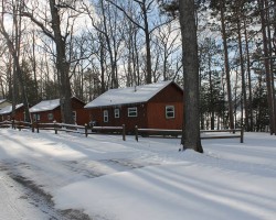
If towns are a pain to go through I have a large area for trailer parking and if I’m full there’s a lot a couple miles up the road.
<>
NEWBERRY AREA UPDATE via TASA – 2/11
February 11, 2023 11:00 am
The trails are very good in the majority of the area. We groomed North to holland lake, trail 45 to the falls and south to cut river and trout lake last night. Tonight we are planning to groom everything again including around town. There is still some logging going on so please ride with caution and care! The details are below for specific trail grooming. It is currently 31 degrees and sunny, hopefully it stays cool! Remember when you are on the side of a road always ride on the right side!
In other news we are raffling off a a 2023 Polaris Sportsman 450 Donated by Renze Power Sports.
Tickets: $100.00 each
Drawing held April 22, 2023 @ 7:00pm at the Elks Lodge in Newberry
300 tickets printed
If less than 125 tickets are sold then the raffle will revert to a 50/50 drawing.
Tickets can be purchased from: Renze Power Sports, Halfway Lake Cottages, North Store Follow Me Outfitters, Pine Stump Restaurant, Schubach Farms Cabin Rentals, or
Rich Rottier 616-550-8201.
Proceeds will go to fund trail grooming equipment! Good Luck!
Stay on the Trail!! Ride Right and Be Safe!! Please be respectful of private property, howbeit it fields or peoples front yards.
Curfew in the Village of Newberry is 11:00pm to 7:00am.
Trail 9: We groomed north to holland lake last night. Conditions are being reported as Very Good! Logging operations are finished and county roads 415 and 422 are now being groomed.
Trail 498: Groomed yesterday. Very Good.
Trail 45: Groomed to the falls last night. Very good The gate is open to the Falls. There is logging on the trail shortly after you jump on Trail 45 just past the Logging museum off of M-123. There is also be logging about 3 miles North of Skyline Road off to the right. Please use extreme caution in these areas! Both portions are being plowed and could be bumpy or rutted. Very Good in spots
Trial 9/2: Groomed to cut river and trout lake last night. Conditions being reported as very good.
Thank you to all the team at the groomers barn who puts in countless hours to keep the system groomed and maintenance on the machines!
Your grooming team from the TASA Barn!!
<>
<>
<>
Visit Tahquamenon Area Snowmobile Association Trail Report
<>
Visit Tahquamenon Area Snowmobile Association on Facebook
<>
Visit Newberry Area Tourism Association on Facebook
<>
Postings From Regional Pages On Facebook

WEATHER UPDATE via Michigan Storm Chasers >> Two forecasts for today, January 13th, 2026, and Wednesday, January 14th, 2026, regarding system snow, then lake effect snow.
Graphic #1
A clipper moves through today, bringing rain/freezing drizzle to portions of northern Michigan and the UP, especially north of M-55, with some light rain as far south as I-94. This will change over to a rain/snow mix later this afternoon and evening. Brief accumulation amounts will generally be in the T-1" range, although a couple spots could exceed 1", which are areas highlighted by the 1-3" zone. Air temperatures today will generally be at or above freezing in the UP, but evaporative cooling will still keep the ground cooler than the air.
Graphic #2
Lake effect snow ramps up beyond midnight tonight, heading into tomorrow, the 14th. Early indications are that the central UP will see the most with flow directly out of the north. Areas of 2-5" and 4-8" have been displayed as a result for much of the Lake Superior shoreline region to account for this flow. The LP is still a little on the uncertain side for overachievers tomorrow. We are watching the usual Gaylord region, but also immediate shoreline areas of Lake Michigan from Traverse City down to New Buffalo, and the thumb, as continued flow out of the north seems like on Thursday. For now, totals will remain as shown, and our last call for tomorrow will be out early in the morning. Inland areas in the T-1" zone may also see slight improvements if balloon launch data today continues to trend in the right direction.
Timing for both days is for the entirety of both days, as precipitation will be on-and-off throughout the next 48 hours. Travel concerns will generally be on the mild side of things, but don't let that fool you. Drive with care no matter what's falling out there. Follow us here at Michigan Storm Chasers for updates throughout the next couple days as the snow falls. #miweather #keweenaw #westernup #munising #newberry #soo #gaylord

NEWBERRY AREA UPDATE via Trails End Lodging >> Good morning from Windy Corners! The wind 🌬️ is blowing and the snow ❄️ is falling!
Where is your day taking you?
It would be a great day for a ride to Windy Corners! Stop into WOLF INN Grill & Spirits for a hot meal and top off at North Store Follow Me Outfitters!
Where ever your day takes you… Ride Safe. Ride Right. #newberry #snowphotos
WEATHER UPDATE via Pictured Rocks Marine Weather Conditions >> Here's the updated 3-day snowfall forecast through 7am Friday morning. This includes some system snow today, then lake-effect snow starting tonight and lasting into Thursday morning, followed by more system snow late Thursday into Friday. Temperatures will be relatively warm today, but will plummet overnight tonight. Back to winter! #miweather #keweenaw #westernup #marquette #munising #seney #newberry #soo #straitsarea
This content isn't available right now
When this happens, it's usually because the owner only shared it with a small group of people, changed who can see it or it's been deleted. WEATHER UPDATE via US National Weather Service Marquette Michigan >> #miweather #keweenaw #westernup #marquette #munising #seney #newberry #soo #straitsarea
WEATHER UPDATE via US National Weather Service Marquette Michigan >> Mixed precipitation, mainly of rain and snow, will spread west to east across the UP tonight into tomorrow morning. Pockets of freezing rain could also mix in at onset and lead to a light glaze of ice on roadways for the Tuesday morning commute. Heavy lake effect snow will then be reinvigorated with a secondary cold front Tuesday night into Wednesday morning across the N and NW wind snow belts. This will combine with northerly winds of 40 to 50 mph, resulting in blowing snow and near zero visibilities for the Wednesday morning commute. #miweather #keweenaw #westernup #marquette #munising #seney #newberry #soo #straitsareaMixed precipitation, mainly of rain and snow, will spread west to east across the UP tonight into tomorrow morning. Pockets of freezing rain could also mix in at onset and lead to a light glaze of ice on roadways for the Tuesday morning commute. Heavy lake effect snow will then be reinvigorated with a secondary cold front Tuesday night into Wednesday morning across the N and NW wind snow belts. This will combine with northerly winds of 40 to 50 mph, resulting in blowing snow and near zero visibilities for the Wednesday morning commute.
NEWBERRY AREA UPDATE via TASA Tahquamenon Area Snowmobile Association >> ⚠️So my wife and I and a couple friends went out to check the trail and get some lunch so I found a couple water holes on trail 9 about 3/4 of a mile off of M123 just slow down they are only 4 inches deep you don’t need to fly though them in the picture you can see my ski in the water that’s the deepest spot so please slow down and take it easy also some of the guys staying at our place got stuck on 45 past the falls I was told the gate was closed over there but they said it was open just be aware that is dangerous over there please do not open gates the people that run their clubs know when to open the gates, so please do not touch them for your safety as well as others.. #newberry #snowphotos
Stan Loos III
WEATHER UPDATE via US National Weather Service Marquette Michigan >> The week starts out dry today with temperatures climbing above freezing across the UP. The next system brings a mix of rain and snow on Tuesday before temperatures turn sharply colder Tuesday night, followed by a round of potentially heavy lake effect snow in the north wind snow belts on Wednesday. Quieter weather on Thursday then gives way to another chance of snow with the next system on Friday. #miweather #keweenaw #westernup #marquette #munising #seney #newberry #soo #straitsareaThe week starts out dry today with temperatures climbing above freezing across the UP. The next system brings a mix of rain and snow on Tuesday before temperatures turn sharply colder Tuesday night, followed by a round of potentially heavy lake effect snow in the north wind snow belts on Wednesday. Quieter weather on Thursday then gives way to another chance of snow with the next system on Friday.
SENEY AREA UPDATE via Seney Snowmobile Association >> Trail 43 South of Seney and Northwest of Seney, Trail 8 heading to the Bear Trap and Trail 440. All reported trails are currently in great shape with excellent riding conditions.
Please use caution on Petrol Lane. There are loggers operating about one mile North of Trail 8.
Trail 431 has a minor detour around the swamp just north of Seney.
*** DO NOT TRY TO GO THROUGH THE SWAMP! IT WAS FROZEN BUT WITH THE WARM UP AND RAIN WE GOT LAST WEEK. THERE"S A DEEP MUD HOLE NOW YOU WILL GET STUCK***
Just use Trail 440 along M-77 once your up by the park and ride Trail 431 is great all the way to Trail 9.
Our Grooming team is grooming trails daily to maintain safe and smooth conditions.
The SSA is using GroomerTracker. The best way to see what’s been groomed is to download the app. If you download their app and follow the SSA. You’ll be able to see where are groomers are and what we’ve groomed. So download their free app today. It only cost you $10 for the year to see where and what we’ve groomed. Half of the fee is donated back to the SSA. Here’s a link so you can download it. www.groomertracker.com
Remember Ride Right and Stay Safe #seney #newberry
NEWBERRY AREA UPDATE via Trails End Lodging >> Good morning from Windy Corners ❄️☀️
Fresh snow overnight and the trails are looking chef’s kiss to start the week!
Nothing beats a snowy Monday in the UP. Where is your week taking you? #newberry #snowphotos
WEATHER UPDATE via Michigan Storm Chasers >> It's noon here on Monday, January 12th, and this week does present a couple instances of lake effect snow throughout the week. As a preliminary first call for the entire week, we've displayed current odds at areas receiving more than 4" of snow based on data from medium range models, and the WPC.
Most of the lake effect snow for the UP will fall between Tuesday and Thursday, where much of the higher elevation areas along Lake Superior currently have a greater than 50% chance at 4" of snow by the end of the work week. For much of the LP, lake effect snow will be confined primarily to Lake Michigan and Lake Huron, especially AFTER Wednesday heading into Thursday. We are keeping an area of 1-20% across much of southern and central Michigan in the event wind shifts or passing clippers allow for extra accumulation, but the greatest chances for 4" will be in the far southwest corner, the thumb, or your typical lake effect zones across northern lower Michigan.
We have lake effect snow forecasts coming all week, along with other forecasts for other weather phenomena such as wind, rain, and perhaps mixed precipitation. Click the follow button on our profile today here at Michigan Storm Chasers! #miweather #keweenaw #westernup #newberry #sooIt's noon here on Monday, January 12th, and this week does present a couple instances of lake effect snow throughout the week. As a preliminary first call for the entire week, we've displayed current odds at areas receiving more than 4" of snow based on data from medium range models, and the WPC.
Most of the lake effect snow for the UP will fall between Tuesday and Thursday, where much of the higher elevation areas along Lake Superior currently have a greater than 50% chance at 4" of snow by the end of the work week. For much of the LP, lake effect snow will be confined primarily to Lake Michigan and Lake Huron, especially AFTER Wednesday heading into Thursday. We are keeping an area of 1-20% across much of southern and central Michigan in the event wind shifts or passing clippers allow for extra accumulation, but the greatest chances for 4" will be in the far southwest corner, the thumb, or your typical lake effect zones across northern lower Michigan.
We have lake effect snow forecasts coming all week, along with other forecasts for other weather phenomena such as wind, rain, and perhaps mixed precipitation. Click the follow button on our profile today here at Michigan Storm Chasers!
-- Trusted Partner of the Day --
McKay Tree Specialists | Turn to your top option in SE Michigan today for all your tree care needs by calling McKay today at 248-308-7308!
GRAND MARAIS AREA UPDATE via Grand Marais Sno-Trails Assoc. >> A view of 888 & 89 this morning from GMT's Tim Flynn.
3 routes groomed last night. Check your groomer tracker app for the pretty colors. We will be back at it tonight. Snow is in the forcast. All good! #grandmarais #newberry #snowphotos
WEATHER UPDATE via US National Weather Service Marquette Michigan >> Light snow will continue moving into the western half of the UP over the next 2 hours. Snow will continue west to east quickly, diminishing in the Keweenaw and central as the night progresses. Snow will diminish in the eastern UP by early morning. #miweather #keweenaw #westernup #marquette #munising #seney #newberry #soo #straitsareaLight snow will continue moving into the western half of the UP over the next 2 hours. Snow will continue west to east quickly, diminishing in the Keweenaw and central as the night progresses. Snow will diminish in the eastern UP by early morning.
Load more
WEATHER UPDATE via Michigan Storm Chasers >> Two forecasts for today, January 13th, 2026, and Wednesday, January 14th, 2026, regarding system snow, then lake effect snow.
Graphic #1
A clipper moves through today, bringing rain/freezing drizzle to portions of northern Michigan and the UP, especially north of M-55, with some light rain as far south as I-94. This will change over to a rain/snow mix later this afternoon and evening. Brief accumulation amounts will generally be in the T-1" range, although a couple spots could exceed 1", which are areas highlighted by the 1-3" zone. Air temperatures today will generally be at or above freezing in the UP, but evaporative cooling will still keep the ground cooler than the air.
Graphic #2
Lake effect snow ramps up beyond midnight tonight, heading into tomorrow, the 14th. Early indications are that the central UP will see the most with flow directly out of the north. Areas of 2-5" and 4-8" have been displayed as a result for much of the Lake Superior shoreline region to account for this flow. The LP is still a little on the uncertain side for overachievers tomorrow. We are watching the usual Gaylord region, but also immediate shoreline areas of Lake Michigan from Traverse City down to New Buffalo, and the thumb, as continued flow out of the north seems like on Thursday. For now, totals will remain as shown, and our last call for tomorrow will be out early in the morning. Inland areas in the T-1" zone may also see slight improvements if balloon launch data today continues to trend in the right direction.
Timing for both days is for the entirety of both days, as precipitation will be on-and-off throughout the next 48 hours. Travel concerns will generally be on the mild side of things, but don't let that fool you. Drive with care no matter what's falling out there. Follow us here at Michigan Storm Chasers for updates throughout the next couple days as the snow falls. #miweather #keweenaw #westernup #munising #newberry #soo #gaylord
NEWBERRY AREA UPDATE via Trails End Lodging >> Good morning from Windy Corners! The wind 🌬️ is blowing and the snow ❄️ is falling!
Where is your day taking you?
It would be a great day for a ride to Windy Corners! Stop into WOLF INN Grill & Spirits for a hot meal and top off at North Store Follow Me Outfitters!
Where ever your day takes you… Ride Safe. Ride Right. #newberry #snowphotos
WEATHER UPDATE via Pictured Rocks Marine Weather Conditions >> Here's the updated 3-day snowfall forecast through 7am Friday morning. This includes some system snow today, then lake-effect snow starting tonight and lasting into Thursday morning, followed by more system snow late Thursday into Friday. Temperatures will be relatively warm today, but will plummet overnight tonight. Back to winter! #miweather #keweenaw #westernup #marquette #munising #seney #newberry #soo #straitsarea
This content isn't available right now
When this happens, it's usually because the owner only shared it with a small group of people, changed who can see it or it's been deleted.WEATHER UPDATE via US National Weather Service Marquette Michigan >> #miweather #keweenaw #westernup #marquette #munising #seney #newberry #soo #straitsarea
WEATHER UPDATE via US National Weather Service Marquette Michigan >> Mixed precipitation, mainly of rain and snow, will spread west to east across the UP tonight into tomorrow morning. Pockets of freezing rain could also mix in at onset and lead to a light glaze of ice on roadways for the Tuesday morning commute. Heavy lake effect snow will then be reinvigorated with a secondary cold front Tuesday night into Wednesday morning across the N and NW wind snow belts. This will combine with northerly winds of 40 to 50 mph, resulting in blowing snow and near zero visibilities for the Wednesday morning commute. #miweather #keweenaw #westernup #marquette #munising #seney #newberry #soo #straitsareaMixed precipitation, mainly of rain and snow, will spread west to east across the UP tonight into tomorrow morning. Pockets of freezing rain could also mix in at onset and lead to a light glaze of ice on roadways for the Tuesday morning commute. Heavy lake effect snow will then be reinvigorated with a secondary cold front Tuesday night into Wednesday morning across the N and NW wind snow belts. This will combine with northerly winds of 40 to 50 mph, resulting in blowing snow and near zero visibilities for the Wednesday morning commute.
NEWBERRY AREA UPDATE via TASA Tahquamenon Area Snowmobile Association >> ⚠️So my wife and I and a couple friends went out to check the trail and get some lunch so I found a couple water holes on trail 9 about 3/4 of a mile off of M123 just slow down they are only 4 inches deep you don’t need to fly though them in the picture you can see my ski in the water that’s the deepest spot so please slow down and take it easy also some of the guys staying at our place got stuck on 45 past the falls I was told the gate was closed over there but they said it was open just be aware that is dangerous over there please do not open gates the people that run their clubs know when to open the gates, so please do not touch them for your safety as well as others.. #newberry #snowphotos
Stan Loos III
WEATHER UPDATE via US National Weather Service Marquette Michigan >> The week starts out dry today with temperatures climbing above freezing across the UP. The next system brings a mix of rain and snow on Tuesday before temperatures turn sharply colder Tuesday night, followed by a round of potentially heavy lake effect snow in the north wind snow belts on Wednesday. Quieter weather on Thursday then gives way to another chance of snow with the next system on Friday. #miweather #keweenaw #westernup #marquette #munising #seney #newberry #soo #straitsareaThe week starts out dry today with temperatures climbing above freezing across the UP. The next system brings a mix of rain and snow on Tuesday before temperatures turn sharply colder Tuesday night, followed by a round of potentially heavy lake effect snow in the north wind snow belts on Wednesday. Quieter weather on Thursday then gives way to another chance of snow with the next system on Friday.
SENEY AREA UPDATE via Seney Snowmobile Association >> Trail 43 South of Seney and Northwest of Seney, Trail 8 heading to the Bear Trap and Trail 440. All reported trails are currently in great shape with excellent riding conditions.
Please use caution on Petrol Lane. There are loggers operating about one mile North of Trail 8.
Trail 431 has a minor detour around the swamp just north of Seney.
*** DO NOT TRY TO GO THROUGH THE SWAMP! IT WAS FROZEN BUT WITH THE WARM UP AND RAIN WE GOT LAST WEEK. THERE"S A DEEP MUD HOLE NOW YOU WILL GET STUCK***
Just use Trail 440 along M-77 once your up by the park and ride Trail 431 is great all the way to Trail 9.
Our Grooming team is grooming trails daily to maintain safe and smooth conditions.
The SSA is using GroomerTracker. The best way to see what’s been groomed is to download the app. If you download their app and follow the SSA. You’ll be able to see where are groomers are and what we’ve groomed. So download their free app today. It only cost you $10 for the year to see where and what we’ve groomed. Half of the fee is donated back to the SSA. Here’s a link so you can download it. www.groomertracker.com
Remember Ride Right and Stay Safe #seney #newberry
NEWBERRY AREA UPDATE via Trails End Lodging >> Good morning from Windy Corners ❄️☀️
Fresh snow overnight and the trails are looking chef’s kiss to start the week!
Nothing beats a snowy Monday in the UP. Where is your week taking you? #newberry #snowphotos
WEATHER UPDATE via Michigan Storm Chasers >> It's noon here on Monday, January 12th, and this week does present a couple instances of lake effect snow throughout the week. As a preliminary first call for the entire week, we've displayed current odds at areas receiving more than 4" of snow based on data from medium range models, and the WPC.
Most of the lake effect snow for the UP will fall between Tuesday and Thursday, where much of the higher elevation areas along Lake Superior currently have a greater than 50% chance at 4" of snow by the end of the work week. For much of the LP, lake effect snow will be confined primarily to Lake Michigan and Lake Huron, especially AFTER Wednesday heading into Thursday. We are keeping an area of 1-20% across much of southern and central Michigan in the event wind shifts or passing clippers allow for extra accumulation, but the greatest chances for 4" will be in the far southwest corner, the thumb, or your typical lake effect zones across northern lower Michigan.
We have lake effect snow forecasts coming all week, along with other forecasts for other weather phenomena such as wind, rain, and perhaps mixed precipitation. Click the follow button on our profile today here at Michigan Storm Chasers! #miweather #keweenaw #westernup #newberry #sooIt's noon here on Monday, January 12th, and this week does present a couple instances of lake effect snow throughout the week. As a preliminary first call for the entire week, we've displayed current odds at areas receiving more than 4" of snow based on data from medium range models, and the WPC.
Most of the lake effect snow for the UP will fall between Tuesday and Thursday, where much of the higher elevation areas along Lake Superior currently have a greater than 50% chance at 4" of snow by the end of the work week. For much of the LP, lake effect snow will be confined primarily to Lake Michigan and Lake Huron, especially AFTER Wednesday heading into Thursday. We are keeping an area of 1-20% across much of southern and central Michigan in the event wind shifts or passing clippers allow for extra accumulation, but the greatest chances for 4" will be in the far southwest corner, the thumb, or your typical lake effect zones across northern lower Michigan.
We have lake effect snow forecasts coming all week, along with other forecasts for other weather phenomena such as wind, rain, and perhaps mixed precipitation. Click the follow button on our profile today here at Michigan Storm Chasers!
-- Trusted Partner of the Day --
McKay Tree Specialists | Turn to your top option in SE Michigan today for all your tree care needs by calling McKay today at 248-308-7308!
GRAND MARAIS AREA UPDATE via Grand Marais Sno-Trails Assoc. >> A view of 888 & 89 this morning from GMT's Tim Flynn.
3 routes groomed last night. Check your groomer tracker app for the pretty colors. We will be back at it tonight. Snow is in the forcast. All good! #grandmarais #newberry #snowphotos
WEATHER UPDATE via US National Weather Service Marquette Michigan >> Light snow will continue moving into the western half of the UP over the next 2 hours. Snow will continue west to east quickly, diminishing in the Keweenaw and central as the night progresses. Snow will diminish in the eastern UP by early morning. #miweather #keweenaw #westernup #marquette #munising #seney #newberry #soo #straitsareaLight snow will continue moving into the western half of the UP over the next 2 hours. Snow will continue west to east quickly, diminishing in the Keweenaw and central as the night progresses. Snow will diminish in the eastern UP by early morning.
<>
Latest Trail Reports – Quick Links
- Keweenaw Peninsula Trail Report – 01/13
- Watersmeet – Western U.P. Trail Report – 01/13
- Newberry Area Trail Report – 01/13
- Ontonagon Area Trail Report – 01/13
- Gaylord Area Trail Report – 01/13
- Frederic / Gaylord Area Trail Report – Sledheads of Frederic – 01/13
- Sault Ste. Marie Area Trail Report – 01/13
- Cadillac Area Trail Report – 01/12
- Munising Area Trail Report – 01/12
- Sidnaw – Western U.P. Trail Report – 01/12
- Seney Area Trail Report – 01/12
- Newberry Area Trail Report – 01/12
- Grand Marais Area Trail Report – 01/12
- Gaylord Area Trail Report – 01/12
- Frederic / Gaylord Area Trail Report – Sledheads of Frederic – 01/12
- Ontonagon Area Trail Report – 01/12
- Traverse City Area Trail Report – 01/12
- Sault Ste. Marie Area Trail Report – 01/11
- Watersmeet – Western U.P. Trail Report – 01/11
- Keweenaw Peninsula Trail Report – 01/11
- Petoskey Area Trail Report – 01/11
- Harbor Springs Area Trail Report – 01/11
- Ontonagon Area Trail Report – 01/11
- Newberry Area Trail Report – 01/11
- Cadillac Area Trail Report – 01/11
- Munising Area Trail Report – 01/11
- Sault Ste. Marie Area Trail Report – 01/10
- Frederic / Gaylord Area Trail Report – Sledheads of Frederic – 01/10
<>