
Traverse City Trail Report – 03/02
TRAVERSE CITY AREA UPDATE via Grand Traverse Area Snowmobile Club – The entire system is getting groomed tonight. Trails should be in great shape by morning. Get out there and enjoy it! …
<>
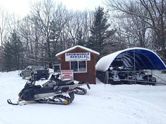
TRAVERSE CITY UPDATE via Blue Sky Rentals – Cool shot from the groomer driver – snow should be good for a while now. Cold temps in the forecast…
<>
Blue Sky Snowmobile Rentals Trail Reports
<>
Grand Traverse Area Snowmobile Club on Facebook >>>>
<>
Area Reports:
Grand Traverse Area Snowmobile Club on Facebook >>>>
Blue Sky Rentals on Facebook >>>>
Visit Grand Traverse Area Snowmobile Club Trail Report on MSA >>>>
<>
Postings From Regional Pages On Facebook
<>
Visit See Traverse City Website >>>>
<>
<>
Traverse City Area Featured Snowmobile Rentals
<>
Latest Trail Reports – Quick Links
- Keweenaw Peninsula Trail Report – 04/05
- Harbor Springs Trail Report – 04/01
- Keweenaw Peninsula Trail Report – 04/01
- Newberry Area Trail Report – 04/01
- Sidnaw – Western U.P. Trail Report – 03/31
- Keweenaw Peninsula Trail Report – 03/31
- Newberry Area Trail Report – 03/31
- Frederic / Gaylord Area Trail Report – Sledheads of Frederic – 03/31
- Gaylord Area Trail Report – 03/31
- Sault Ste. Marie Area Trail Report – 03/30
- Newberry Area Trail Report – 03/29
- Grand Marais Area Trail Report – 03/29
- Keweenaw Peninsula Trail Report – 03/28
- Harbor Springs Area Trail Report – 03/28
- Sault Ste. Marie Area Trail Report – 03/28
- Munising Area Trail Report – 03/28
- Lake Gogebic Area Trail Report – 03/27
- Gaylord Area Trail Report – 03/27
- Harbor Springs Area Trail Report – 03/27
- Newberry Area Trail Report – 03/27
- Keweenaw Peninsula Trail Report – 03/26
- Lake Gogebic Area Trail Report – 03/26
- Paradise Area Trail Report – 03/26
- Munising Area Trail Report – 03/25
- Drummond Island Trail Report – 03/25
- Sault Ste. Marie Area Trail Report – 03/25
- Paradise Area Trail Report – 03/24
- Grand Marais Area Trail Report – 03/24
<>
